
Johns Hopkins University, whose global count of COVID-19 cases and deaths has become one of the most popular sources for information about the disease, has unveiled a new United States map that dives into the pandemic on a county level.
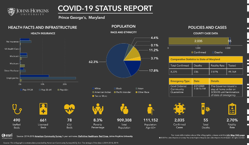
The U.S. map provides information about counties’ health infrastructure, population and policies and cases related to COVID-19, the disease caused by the coronavirus.
Image: Johns Hopkins University’s map tracking the COVID-19 has added county data, including snapshot infographics, like this one of Prince George’s County, for every county in the country. (Johns Hopkins University)
